|
Scientific and Natural Stewardship
GEOLOGY
 The Blue Ridge The Blue Ridge
Region
 BRCES Lands Close Up BRCES Lands Close Up
BRCES LANDS CLOSE UP
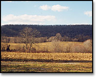
The 900 acre Foundation property, like so much of the Blue Ridge, is geologically complex. It is part of the Harpers Ferry quadrangle, covering a portion of the Blue Ridge-South Mountain area.
Elevations on the property range from 500 feet above sea level on the eastern edge to nearly 1,000 feet above sea level atop the ridgeline.
The Blue Ridge consists of up-thrust belts of rock that have been subjected to intense metamorphic deformation, and a bedrock of sandstone, sometimes capped by quartzite (the remains of ancient sand bars), metabasalt, and gneiss underlies the Foundation property.
Through time, these materials tend to erode, sloughing off the main ridges in blocks and plates. The western half of the property, as a result, is composed of steep ledges surrounded by immense fields of jagged boulders. The thin rocky soils of these upland zones give way to the richer top soils in the bottomland and riparian environment found along Piney Run.

Our Farm |
Our Land |
Blue Ridge Press
News from the Ridge |
Contact Us |
Site Map |
Home
© Copyright 2001, Blue Ridge Center for Environmental Stewardship.
All rights reserved.
|