|
Scientific and Natural Stewardship
BOTANICAL/VEGETATIVE BASELINE INVENTORY
SUMMARY OF FINDINGS
Fifteen distinct habitats have been located and studied on the Robert and Dee Leggett Foundation property, ranging from a maturing chestnut oak ridgetop forest, to young recovering upland and riparian forests.
Loudoun County, Virginia, is in a transitional zone, and our property represents a rich mix of northern and southern trees. The primary forest community type on the property is the mixed mesophytic forest, with tulip poplar, a variety of oaks, and maples and hickory types numbering among the dominant tree species. Common understory species include slippery elm, beech, dogwood, and redbud. The typical shrub layer includes spice bush, blackberry, with some mountain laurel. Bottomland is inhabited by typical wetland species such as sycamore and buttonbush. Wildflowers identified include naked leaved pink trefoil and velvet leaf.
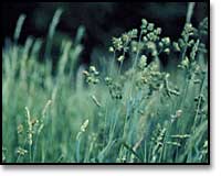 Numbering among the most common invasive plants are ailanthus (tree of heaven), Chinese sumac, white mulberry, Japanese honeysuckle, garlic mustard, barberry, multiflora rose, and spotted knapweed.
STUDIES TO DATE
A biological survey was begun in 2000 by students from Millsaps College, Jackson, Miss. The goal of this survey is to identify major habitat types on the 900 acre property, and then to record the plant varieties within these habitat types. The student researchers documented trees, shrubs, flowers, and ferns. As part of the botanical identification process, a map is being prepared to chart the precise extent and location of each habitat.
The program provides students with experience in biological field methods, while documenting the ecological features of the land surrounding the Blue Ridge Center for Environmental Stewardship.
Review Botanical Data

Our Farm |
Our Land |
Blue Ridge Press
News from the Ridge |
Contact Us |
Site Map |
Home
© Copyright 2001, Blue Ridge Center for Environmental Stewardship.
All rights reserved.
|